Clark County, Nevada
| Clark County, Nevada | ||
|
||
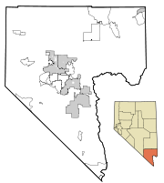
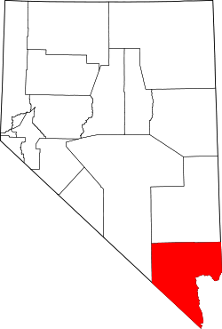 Location in the state of Nevada |
||
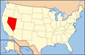 Nevada's location in the U.S. |
||
| Founded | February 5, 1908 | |
|---|---|---|
| Seat | Las Vegas | |
| Largest city | Las Vegas | |
| Area - Total - Land - Water |
8,091 sq mi (20,956 km²) 7,910 sq mi (20,487 km²) 180 sq mi (466 km²), 2.23% |
|
| Population - (2000) - Density |
1,375,765 181/sq mi (70/km²) |
|
| Time zone | Pacific: UTC-8/-7 | |

Clark County is a county located in Southern Nevada. The county had a population of 1,375,765 at the 2000 census, and a 2008 estimated population of 1,996,542,[1] which accounts for over three-quarters of the population of Nevada. It contains the city of Las Vegas, the state's most populous city. Las Vegas has been the county seat since the county was created. The county was formed by the Nevada Legislature by splitting off a portion of Lincoln County on February 5, 1909,[2] and came into existence on July 1, 1909.[3]
Much of the county was originally part of Pah-Ute County, Arizona Territory before Nevada became a state. The county was named for William Andrews Clark, a Montana copper magnate and U.S. Senator. Clark was largely responsible for the construction of the Los Angeles and Salt Lake Railroad through the area, a factor heavily contributing to the region's early development.
Clark County is also a major tourist destination, with 150,000 hotel and motel rooms. The Las Vegas Strip, home to most of the hotel-casinos known to many around the world, is not located within the City of Las Vegas, but in unincorporated Paradise.
Contents |
Geography
According to the U.S. Census Bureau, the county has a total area of 8,091 sq mi (20,960 km2). Land covers 7,910 sq mi (20,500 km2) and water covers 180 sq mi (470 km2) (2.23%).
The Colorado River forms the county's southeastern boundary, with Hoover Dam forming Lake Mead along much of its length. The lowest point in the state of Nevada is located on the Colorado River just south of Laughlin in Clark County, where it flows out of Nevada and into California and Arizona. Las Vegas is a valley. By definition, Greater Las Vegas is a tectonic valley, surrounded by four mountain ranges, with nearby Mount Charleston being the highest elevation at 11,918 ft (3,633 m), located to the northwest. Other than the forests on Mount Charleston, the geography in Clark County is a desert. Creosote bushes are the main native vegetation, and the mountains are mostly rocky with little vegetation.
Adjacent counties
- Lincoln County - north
- Nye County - west
- Inyo County, California - southwest
- San Bernardino County, California - south
- Mohave County, Arizona - east
 |
Lincoln County | |
||
| Nye County | Mohave County, Arizona | |||
| Inyo County, California | San Bernardino County, California |
Demographics
| Historical populations | |||
|---|---|---|---|
| Census | Pop. | %± | |
| 1910 | 3,321 |
|
|
| 1920 | 4,859 | 46.3% | |
| 1930 | 8,532 | 75.6% | |
| 1940 | 16,414 | 92.4% | |
| 1950 | 48,289 | 194.2% | |
| 1960 | 127,016 | 163.0% | |
| 1970 | 273,288 | 115.2% | |
| 1980 | 463,087 | 69.5% | |
| 1990 | 741,459 | 60.1% | |
| 2000 | 1,375,765 | 85.5% | |
| Est. 2009 | 1,902,834 | [4] | 38.3% |
| sources:[5][6] | |||
As of the census[7] of 2000, there were 1,375,765 people, 512,253 households, and 339,623 families residing in the county. The population density was 174 people per square mile (67/km²). There were 559,799 housing units at an average density of 71 per square mile (27/km²). The racial makeup of the county was 61.58% white, 10.18% black or African American, 7.27% Asian, 0.79% Native American, 8.61% from other races, and 4.20% from two or more races. Hispanic or Latino of any race were 21.96% of the population.
In 2000 there were 512,253 households out of which 31.70% had children under the age of 18 living with them, 48.70% were married couples living together, 11.80% had a female householder with no husband present, and 33.70% were non-families. 24.50% of all households were made up of individuals and 6.70% had someone living alone who was 65 years of age or older. The average household size was 2.65 and the average family size was 3.17.
In the county the population was spread out with 25.60% under the age of 18, 9.20% from 18 to 24, 32.20% from 25 to 44, 22.30% from 45 to 64, and 10.70% who were 65 years of age or older. The median age was 34 years. For every 100 females there were 103.50 males. For every 100 females age 18 and over, there were 102.80 males.
The median income for a household in the county was $53,536, and the median income for a family was $59,485.[8] Males had a median income of $35,243 versus $27,077 for females. The per capita income for the county was $21,785. About 7.90% of families and 10.80% of the population were below the poverty line, including 14.10% of those under age 18 and 7.30% of those age 65 or over.
Tourism

The Las Vegas Convention and Visitors Authority post the historical numbers of visitors and hotel rooms in Clark County. The era of massive modern casino resorts began with the opening of the Mirage in November 1989. Generally the increase in hotel rooms has been matched by an increasing number of visitors until 2008. An unmatched building boom has been met with declining numbers of tourists. If the 7.2% percentage decrease in the first four months of 2009 were to continue for the year, visitors would dip below 35 million, which is the level that they were at before the year 2000.
Law and government
| Year | Democrat | Republican |
|---|---|---|
| 2008 | 58.47% 380,765 | 39.48% 257,078 |
| 2004 | 51.72% 281,767 | 46.81% 255,337 |
| 2000 | 51.31% 196,100 | 44.72% 170,932 |
| 1996 | 48.71% 127,963 | 39.37% 103,431 |
| 1992 | 41.15% 124,586 | 32.17% 97,403 |
| 1988 | 40.86% 78,359 | 56.37% 108,110 |
| 1984 | 35.50% 53,386 | 62.60% 94,133 |
| 1980 | 30.07% 38,313 | 59.80% 76,194 |
| 1976 | 49.78% 51,178 | 46.92% 48,236 |
| 1972 | 40.94% 36,807 | 59.06% 53,101 |
Clark County Government is run by the Clark County Commission which consists of 7 members who are elected to serve staggered 4 year terms in biannual partisan elections.
After each election, the members elect a chairman who runs the commission meetings. Actual day-to-day operations are handled by the county manager who is hired by the commission. Its unincorporated towns also have appointed boards that provide advice to the commission.
The county operates out of the Clark County Government Center located in the City of Las Vegas. The building is unusual in shape, and includes an outdoor amphitheater where concerts and other events are held.
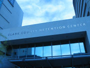
The Las Vegas Metropolitan Police Department provides most law enforcement services in the county, including operation of the county's central jail, officially named the Clark County Detention Center, usually called CCDC for short. The present department was created in 1973 when the Clark County Sheriff's Department merged with the Las Vegas Police Department.
Other entities that have their own police forces include University of Nevada, Las Vegas, the Clark County School District, and cities such as Henderson, Mesquite, Boulder City and North Las Vegas. The Clark County Park Police is responsible for all of the parks operated by the county and some selected special venues, such as the Clark County Amphitheater, Clark County Archery Range, and the Desert Rose Golf Course.
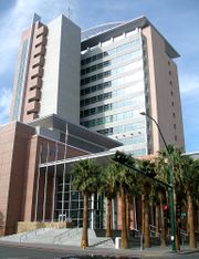
The Regional Justice Center replaced the Clark County Courthouse in 2005, and is located about 3 blocks from downtown Fremont Street, at 200 Lewis Avenue.
Regional agencies
Clark County Regional Flood Control District
The Clark County Regional Flood Control District (CCRFCD) was created in 1985 by the Nevada Legislature allowing Clark County to provide broad solutions to flooding problems.
Clark County School District
Public primary and secondary education is the responsibility of the Clark County School District.
Regional Transportation Commission of Southern Nevada
Operates the Cat Bus and does planning for most major roadways.
Southern Nevada Water Authority
A multi-agency group that manages the water distribution for the Las Vegas valley.
Las Vegas Wash Coordination Committee
The group that manages and protects the Las Vegas Wash.
Since 1999 the group has added more the 15,000 plants to stabilize the wash's banks and restore and expand the wetlands surrounding the wash. As part of the effort to restore the wash to a more natural state, they have also removed more than 500,000 pounds of trash.
Communities
Cities
Census-designated places
- Blue Diamond
- Mountain's Edge
- Bunkerville
- Cal-Nev-Ari
- Enterprise
- Fort Mojave Indian Reservation (part)
- Goodsprings
- Indian Springs
- Laughlin
- Moapa Town
- Moapa Valley
- Mount Charleston
- Paradise
- Sandy Valley
- Searchlight
- Spring Valley
- Summerlin South
- Sunrise Manor
- Whitney (formerly East Las Vegas)
- Winchester
Other communities
- Arden
- Cactus Springs
- Cottonwood Cove
- Coyote Springs (planned)
- Glendale
- Jean
- Logandale
- Mountain Springs
- Nelson also called Nelson Landing
- Overton
- Primm
- Sloan
Federal land
- Creech AFB
- Desert National Wildlife Refuge (part)
- Humboldt-Toiyabe National Forest (part)
- Lake Mead National Recreation Area (part)
- Moapa Valley National Wildlife Refuge
- Mount Charleston Wilderness
- Nellis AFB
- Red Rock Canyon National Conservation Area
- Sloan Canyon National Conservation Area
- Spring Mountains National Recreation Area (part)
- Toiyabe National Forest (part)
Transportation
Major highways
 Interstate 15
 Interstate 215
 Interstate 515
 U.S. Route 93
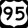 U.S. Route 95
 State Route 157
 State Route 159
 State Route 160
 County Route 215
Parks and recreation
-
- Sunset Park located at Sunset and Pecos is one of the largest[9]
Gaming areas
The State of Nevada divides the state into several gaming districts. The reporting districts affecting Clark County are:[10][11]
- Boulder Strip: This region includes 33 casinos on Boulder Highway, such as Sam's Town, Boulder Station, Arizona Charlie's Boulder, and the Magic Star. Casinos within the Henderson city limits are included as well, such as Green Valley Ranch, Sunset Station, Fiesta, Eldorado, and Jokers Wild.
- Downtown: There are 19 casinos in this reporting area.
- LV Strip: This region is composed of all the casinos on Las Vegas Boulevard, from The Stratosphere at the north end to Mandalay Bay on the south end. Also included are resorts located near this area, such as The Rio, South Point, and the Hard Rock; and McCarran Airport.
- North Las Vegas: This region has 11 casinos and include the Fiesta, Texas Station, Jerry's Nugget, and the Santa Fe Station.
- Laughlin: The casinos in Laughlin.
- Mesquite: The casinos in Mesquite.
- Balance of County: There are 66 casinos in this category that includes casinos at Lake Las Vegas, Jean, Primm, the Railroad Pass and Hacienda casinos, along with other casinos that don't fit any other category such as Arizona Charlie's Decatur, Gold Coast, The Orleans, The Palms, Suncoast, Rampart, and Red Rock Resort Spa and Casino
Environmental factors
Clark County contains a diverse desert flora and fauna, including higher elevation mountain areas, the desert floor and the Colorado River/Lake Mead ecosystems. Variations in diurnal temperature as well as seasonal swings in temperature create demanding adaptation elements on the species of this county. Additional pressure has been placed on species survival by the rapid human population expansion, especially since 1970.
Correspondingly air quality levels prior to the 1960s were in a favorable range, but the proliferation of automobiles with the human population expansion created circumstances where some Federal Air Quality Standards began to be violated in the 1980s.
To plan for the wave of development forecast by 1980, Clark County embarked on a regional Environmental Impact Assessment funded by a Federal Section 208 program, with Sedway Cooke conducting the planning work and Earth Metrics performing environmental analysis. This endeavor projected future population growth, land use changes and environmental impacts.
To prevent the loss of federal funds due to unacceptable dust levels in the Las Vegas valley, in 2003 the Nevada Air Quality Management division (under direction of Clark County officials) created the massive "Don't Be a Dusthole" campaign. The campaign successfully raised awareness of dust pollution in the Las Vegas valley, quantifiably reducing pollutants and preserving ongoing federal funding.[12]
Located in Apex is the Apex Landfill which at 2,200 acres (890 ha) is the largest landfill in the United States.[13] Republic Services owns and operates the landfill.
Economy
Station Casinos is headquartered in unincorporated Clark County.[14][15]
Notable government buildings
- Clark County Government Center
- Regional Justice Center (opened October 3, 2005)
See also
- Clark County Airports
- Clark County Fire Department
References
- ↑ http://www.lvrj.com/news/12144671.html
- ↑ Las Vegas Sun, January 4, 2009; Joseph Nathan Kane, The American Counties (4th Ed.), (The Scarecrow Press, 1983), p479-480
- ↑ Squires, C. P.. The History of Nevada. Nevada's Online State News Journal. p. 801. http://www.nevadaobserver.com/History%20Of%20Clark%20County%20(1912).htm. Retrieved 2009-07-25.
- ↑ http://factfinder.census.gov/servlet/DTTable?_bm=y&-context=dt&-ds_name=PEP_2009_EST&-CONTEXT=dt&-mt_name=PEP_2009_EST_G2009_T001&-tree_id=809&-redoLog=true&-_caller=geoselect&-geo_id=05000US32003&-search_results=05000US06037&-format=&-_lang=en
- ↑ census.gov Nevada population by county, 1900-90 accessed 2009-05-14
- ↑ quickfacts.census.gov - Clark County accessed 2009-05-14
- ↑ "American FactFinder". United States Census Bureau. http://factfinder.census.gov. Retrieved 2008-01-31.
- ↑ Clark County, Nevada - Income in the Past 12 Months (In 2006 Inflation-Adjusted Dollars)
- ↑ Sunset Park at About.com
- ↑ "Abbreviated Revenue Release Index". Nevada Gaming Control Board. http://gaming.nv.gov/mrrindex.htm. Retrieved 2009-05-03.
- ↑ "February 2009 Nevada Gaming Revenues and Collections". Press release. 2009-04-07. http://gaming.nv.gov/documents/pdf/mrrfeb09.pdf. Retrieved 2009-05-03.
- ↑ reviewjournal.com - News - Dusty the Dusthole successful
- ↑ Schoenmann, Joe (2008-12-17). "Official calls for sort reform". Las Vegas Sun. http://m.lasvegassun.com/news/2008/dec/17/official-calls-sort-reform/. Retrieved 20 December 2008.
- ↑ "Interactive Map Viewer." City of Las Vegas. Retrieved on June 5, 2009.
- ↑ "Map." Station Casinos. Retrieved on June 5, 2009.
External links
- Clark County, Nevada Government and Services
- Clark County Television (County of Clark owned television station with Live Internet Feed)
- Detailed map of Clark County (Census Bureau Map, little street detail) (pdf, 32 Mb)
|
|||||||||||||||||
|
|||||||||||||||||||||||